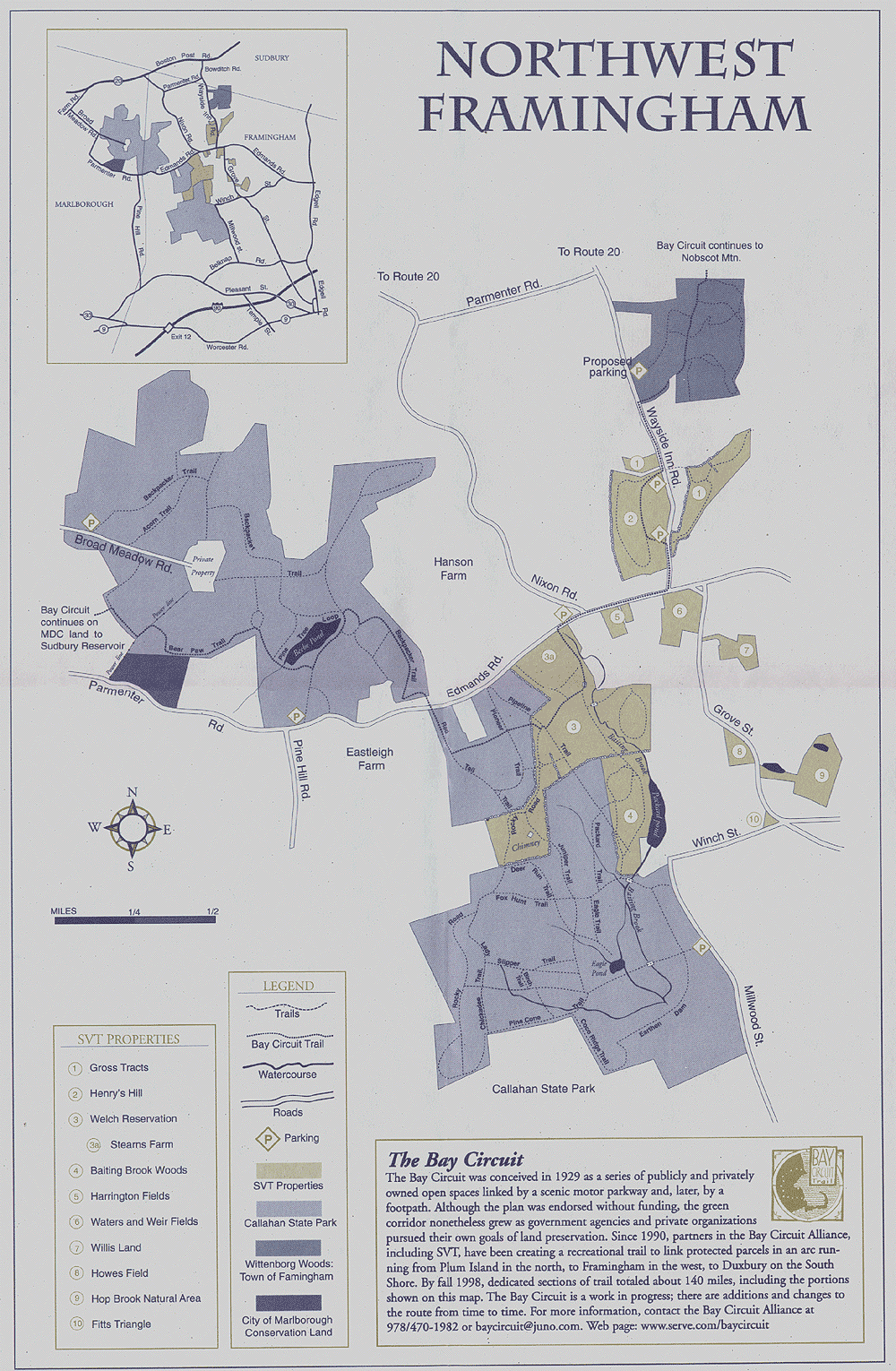
| Sudbury Valley Trustees (www.sudburyvalleytrustees.org) owns property adjacent to and nearby Callahan State Park. Membership in this organization is highly recommended. One of the member benefits is trail maps such as this one covering all of northwest Framingham. |
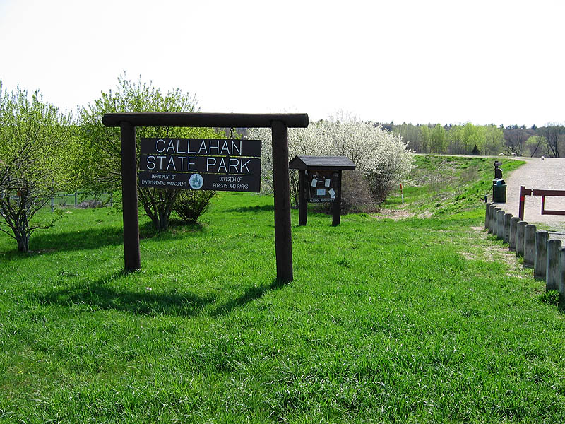
Callahan Cache takes you into Callahan Park, hundreds of acres of public space in the northwest corner of Framingham. People who think of Framingham as Route 9 and shopping malls will be surprised to find this very rural corner of town.
Because the park is so large it didn't seem fair to have seekers just
take a quick hike in and out, so this was made a 3 part multi-cache
that will allow you to see more of the park. It should not be overly
difficult but you should plan about an hour (assuming you don't get
seriously lost!) and plan for trails that have leaves, embedded rock
and roots and in some places are somewhat steep.
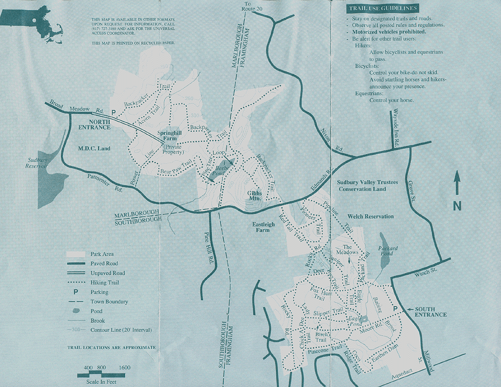
| The Massachusetts Department of Environmental Management provides a trail map for Callahan State Park that is (sometimes!) available at the two main parking lots. Click here for a scanned copy of the map. |
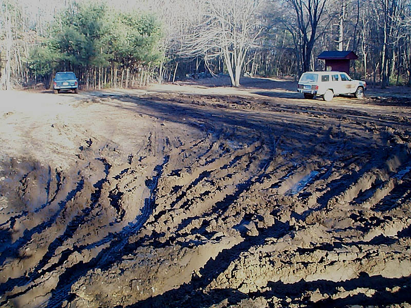
The main parking lot is on Millwood Street across from the golf club, at 42° 19.23N 71° 27.80W. The lot is pretty large, but gets lots of users. A secondary parking lot is on Edmands Road at 42° 19.88N 71° 28.53W and is much less used. Parking in the main lot will result in a somewhat shorter trip and avoid some of the steeper trails.
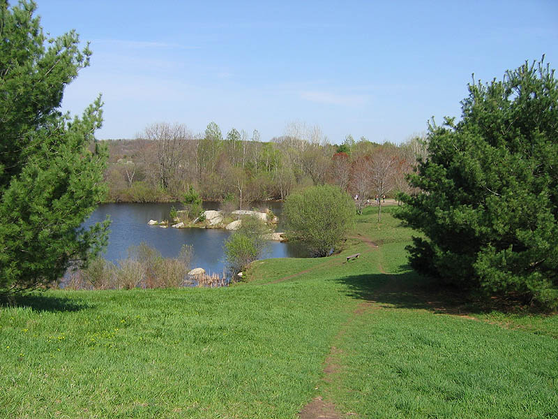
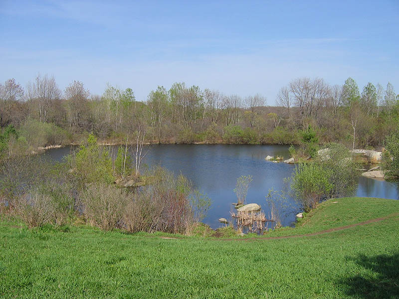
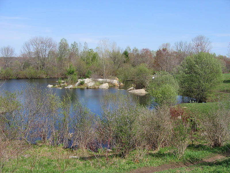
Continue on for a picture tour of the south side of the park.
|
Two parking areas are suitable for this cache. On the left is the main parking lot on Millwood Street across from the golf course. On the right is the Edmands Road parking lot during mud season! |
|
|
|
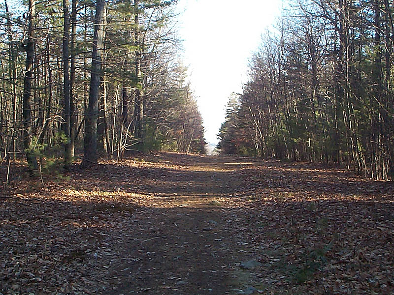
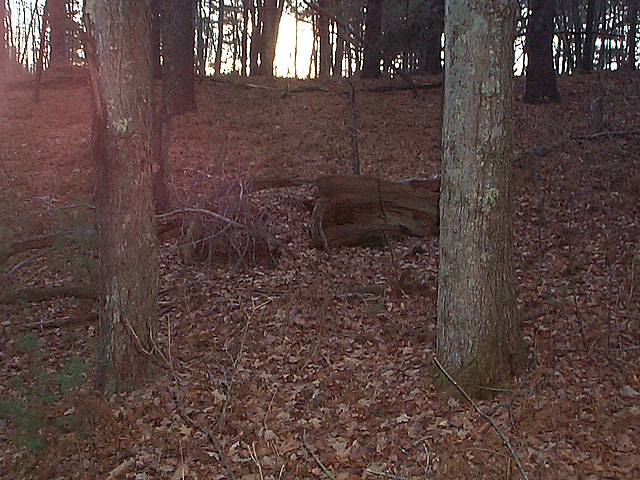
If you park at the Edmands Road entrance the main trail (left) into the park is wide and, for a short distance, steep. It's one of the few places offering a view of the distance. The park offered a number of potentially interesting spots for a hiding a cache. This stump is one that was considered but not used. |
|
|
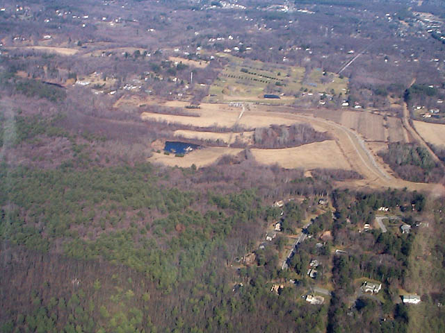
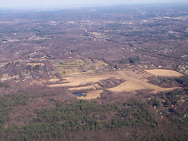
Here's what the southern part of the park looks like from 2000 feet above. You can see Eagle Pond, the large fields next to it, the Earthen Dam trail and the woods to the left where you will be hiking. |
|
Warning!
Continue to the rest of the photo gallery.
Callahan Cache Page at Geocaching.com