
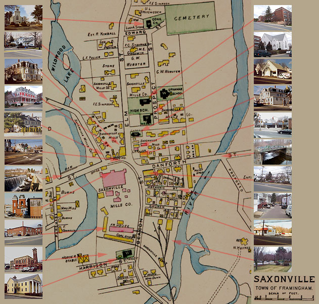
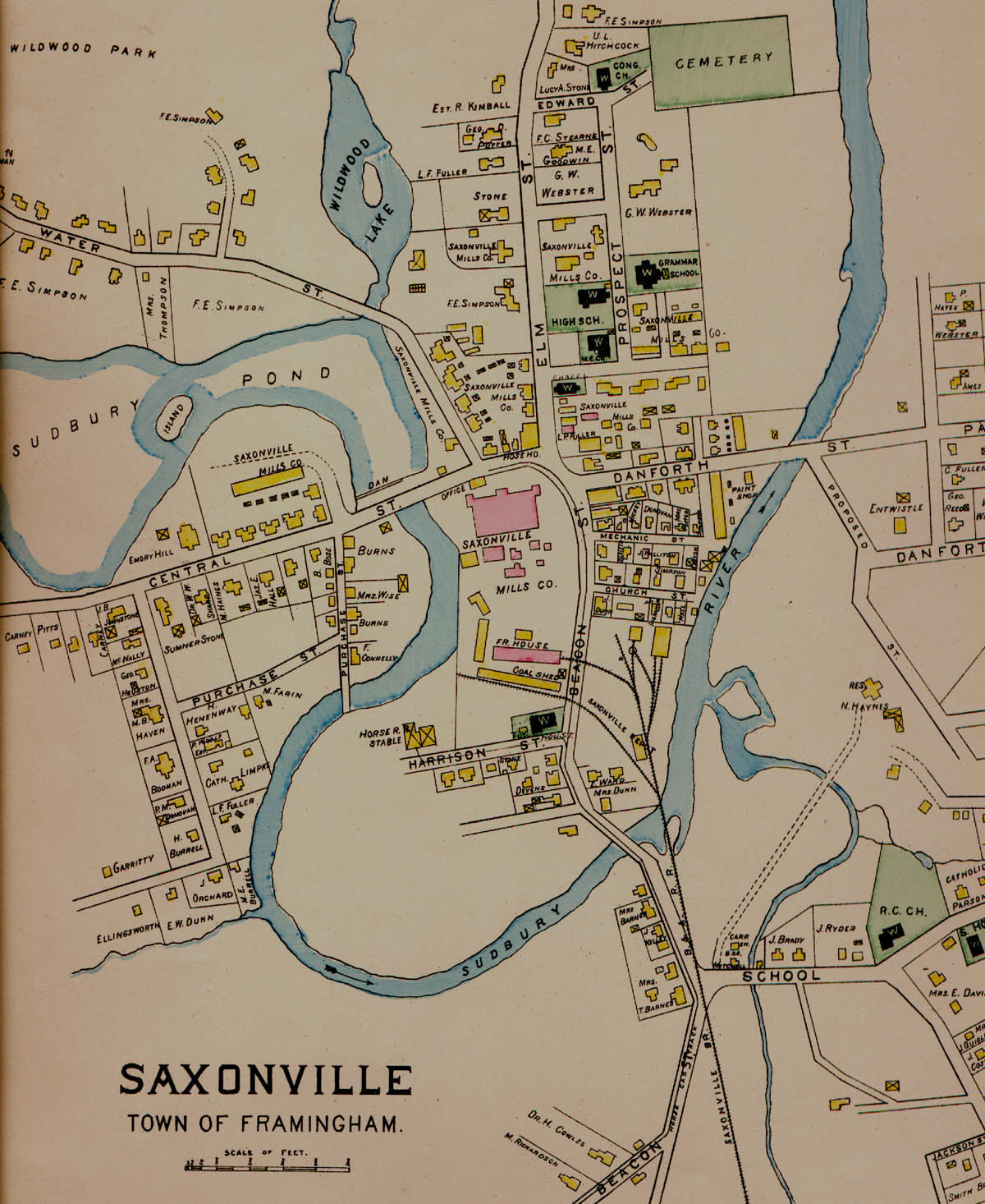
Saxonville In 1889
This is a portion of a map from the 1889 Geo. A Walker atlas. The rather
large maps in this atlas show a great deal of detail, right down to
individual house owner's names. It's interesting to note, though, that
the map is older that some of the historic sites on the Saxonville Historic
Walking Tour, so they are not shown on the map. Arrows point to their
approximate location.
For a larger view of this map, without the photo thumbnails, click
here.
Other Choices
Historical Walk
1889 Geo. A Walker Map
1882 3D Aerial View
Saxonville Nature Trail
Back
Home